Tracely
GPX → 3D flyover → film

Your route, flown in 3D.

Open any GPX track and watch it fly over the real terrain. Then export a film with your stats, ready for Stories, Reels or YouTube.

Works in your browser, nothing to install. iPhone app coming to the App Store.
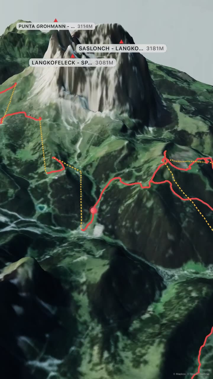
Dolomites 71.2 km 6 992 m vertical 23 runs
A Tracely flyover: the red route line of a day on the slopes winds past the Sassolungo in the Dolomites, with peak and village labels.
Made with Tracely · 9:16 film
How it works

From track to film in a minute.

Open a GPX

Any track from your watch, phone or bike computer. No file at hand? Try the demo route.

Fly the real terrain

Satellite imagery on true 3D elevation. Orbit, tilt, press play, scrub the elevation profile.

Export the film

Pick a look and a frame, and get an MP4 that ends with your stats.

Features

Every climb deserves a better replay than a flat line.

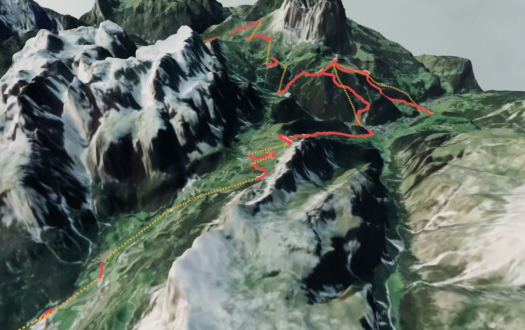
Satellite imagery draped over the 3D Sella massif in the Dolomites, with the route and lifts in red and yellow. © Mapbox © OpenStreetMap
Real terrain

Mountains that look like mountains.

Mapbox satellite imagery draped over real elevation data, with peaks and passes labelled from OpenStreetMap.

Film looks

Three looks, three frames.

Quick for a teaser, Cinematic for the full story, Relaxed to take in the view.

Quick10 sCinematic20 sRelaxed30 s
9:1616:91:1
Stats

Every climb, in numbers.

Distance, climb, descent, highest and lowest point, and a profile you can scrub.

6 992m
vertical, one day in the Dolomites
My routes

All your routes, one tap away.

On the web, sign in with Apple or Google and your routes follow you to any browser.

  • Dolomites71.2 km · 23 runs
  • Eiger Trail5.9 km · ↑ 769 m
iPhone app

Record it on the go.

Track a hike, run or ride in the iPhone app, even with the screen locked, then fly it the moment you stop.

0:07:05

No ads. No subscription. Your routes are yours.

The iPhone app needs no account and keeps every route on your device. On the web, guests watch any GPX without uploading it. Our analytics count a few app events, never your routes or location.

On iPhone

Made for the phone in your pocket.

  • Your route, flown in 3D: the route viewer with a red track over satellite terrain, live altitude, distance and grade at the top, and the route sheet with an elevation profile.
  • Record any hike, run or ride: the live recording screen with a mini-map, moving time 0:07:05, distance 1.30 km and ascent 237 m.
  • Pick a film look: the Quick, Cinematic and Relaxed presets with 9:16, 16:9 and 1:1 frames and a Create video button.
  • Export a video, ready to share: the finished film with Save to Photos, Share and Save to Files.
  • Every climb, in numbers: the film's end card for the Eiger Trail, 5.9 km, 769 m climb, 2330 m highest point, 65 m descent.
  • All your routes, one tap away: My routes with five saved routes, each with a track thumbnail, distance and climb.

Bring a GPX. Leave with a film.

Open the web app and try it on the demo route. No sign-up needed to look around.